The cover of Western Teleport depicts a collission between two neon schematics of the 405/110 interchange in Los Angeles, officially named the Pregerson Interchange a. I was obsessed with it the time, and I wanted this monumental public works project reflected in the album art. The semi-abstract result is an image of neon exit ramps threading into one another in impossible-looking knots.
I wrote to Dieter Brehm (IG) to help me realize something similar for the album art for The Lakes of Zones B and C. The result is a collaborative effort, with most of the skilled labor performed by Dieter. Here’s what I said to him in April 2020:
“The cover art is kind of a companion piece to Western Teleport. Whereas that one was an overlay and manipulation of two interwoven Pregerson interchanges…this one will do something similar with contour maps of the depth findings of two Berlin lakes, one called Tegeler See and the other called Schlachtensee…What works well about the Western Teleport cover image is that it looked recognizable at small sizes, or from a distance. It is simple, but also detailed if someone wanted to look closely — and this is a good resonance with good pop music which has the same qualities, the simplicity on first glance but great detail once listened to for long enough. That combination of cleanliness, of very illustrated/firm lines without any gradients, colours with thin black outlines, governed cartoon-like objects, etc., with very messy, alive, bursting subject matter. Does that make sense?”
It doesn’t, but Dieter got it and asked to see more info about Tegeler See and Schlachtensee. I sent him the following.
// // //
From Umweltbundesamt (2011), there are some low-detail but nicely-rendered contour maps of the two lakes in question. This is also nice because it gives you an English description of the lake system of Berlin, and hints at why I find it so interesting.
Source: https://www.umweltbundesamt.de/sites/default/files/medien/461/publikationen/4144.pdf
p. 25: map of the Berlin-Brandenburg region’s lake system
p. 26: “vital stats” comparison of Tegeler See and Schlachtensee
p. 35: contour map of Tegeler See
p. 38: contour map of Schlachtensee
p. 54: cyanobacteria levels in mud cores (a nice-looking chart, particularly the bottom half with the differently-sized black dots; you will find other examples of this kind of chart throughout, too)
// // //
For even deeper (ha) context, though this document is unfortunately only available in German as far as I know, this is an atlas of Berlin lakes. It includes not just Tegeler See and Schlachtensee bathymetric contours but also every damn lake there is in Zones A, B, and C, so feel free to scroll around and immerse yourself in the lake-ness. All data and images courtesy of the public Senatsverwaltung für Stadtentwicklung (2002).
Source: https://www.berlin.de/senuvk/umwelt/wasser/wasserrecht/pdf/wasseratlas.pdf
p. 22: a more detailed, but very badly-rendered, contour map of Tegeler See
p. 70: a more detailed, but very badly-rendered, contour map of Schlachtensee
p. everywhere: lots of stuff, scroll around!
// // //
One quick addition, from Ladwig et al. (2018)
https://www.mdpi.com/2073-4441/10/2/186/htm
Fig. 1: bathymetric data for Tegeler See
Fig. 4: it’s just pretty 🙂
// // //
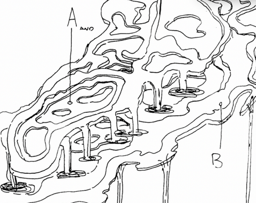
A few weeks later he sent me this, and we were rolling.
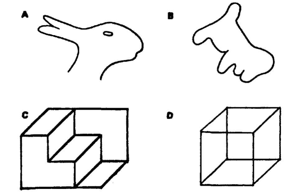
Good art is often multi-interpretable. Few humans can look at an abstract/random or raw-data image and avoid trying to discern a pattern or tell a story. The images that fascinate me suggest instant possible interpretation but also allow for other interpretations. Experimental psychologists refer to this as image stability or figure ambiguity (Chambers and Reisberg, 1985) and a lot of famous image-games fit this as well.
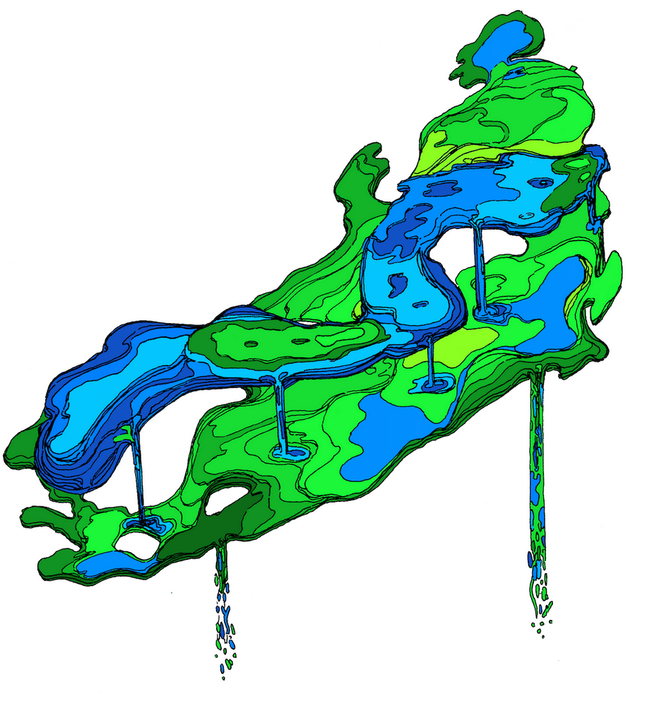
When viewing the depth finding-inspired lake images, I had one stable interpretation immediately. I saw Dieter’s rendering of the bathyspheric data and wrote this.
“Here’s the ‘story,’ both abstract and concrete. Suspend everything you know about physics and just visualise this. I’m trying to explain the image you created above, sort of retcon it into our universe…Once upon a time, two lakes float in interstellar space. They are liquid, warm, teeming with life, but not spherical as such a lake would be in our universe. They are flat on top like Earth lakes are — like, if you froze a lake, then teleported it into interstellar space and constrained it to hold shape as it would under the influence of [Earth’s near-field planar-approximate] gravity and its lake bed…so they hold shape but behave as a drifting liquid otherwise. Let’s say that semi-magical process happens to Tegeler See and Schlachtensee. They drift around the void for eons, each a sustainable ecosystem. They meet. What we’re seeing is how they would interact if they met, according to the strange physics and biology of this imagined universe. The interaction is gravity-like, and rational, but follows different rules than Newtonian physics (or any physics we know of). They meet skew — not exactly orthogonal, just a bit mis-aligned, exactly as you have drawn above….No surrealism, no hidden faces…like a topology, like a map of these two lakes that a passing starship makes on its scanner screens for analysis…like if an Urban Sketchers person were onboard the Enterprise drawing, but with our lakes instead of a black hole [on the viewscreen.]…non-Euclidean lakes floating in space.”
That’s where this image comes from. You’ll start seeing it, and various re-colored permutations of it, from me over the next few months.